The Integration of Ecosystem Services in Planning: An Evaluation of the Nutrient Retention Model Using InVEST Software
Mapping ecosystem services (ES) increases the awareness of natural capital value, leading to building sustainability into decision-making processes. Recently, many techniques to assess the value of ES delivered by different scenarios of land use/land cover (LULC) are available, thus becoming important practices in mapping to support the land use planning process. The spatial analysis of the biophysical ES distribution allows a better comprehension of the environmental and social implications of planning, especially when ES concerns the management of risk (e.g., erosion, pollution).
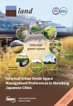
Informal Urban Green Space: Residents’ Perception, Use, and Management Preferences across Four Major Japanese Shrinking Cities
Urban residents’ health depends on green infrastructure to cope with climate change. Shrinking cities could utilize vacant land to provide more green space, but declining tax revenues preclude new park development—a situation pronounced in Japan, where some cities are projected to shrink by over ten percent, but lack green space. Could informal urban green spaces (IGS; vacant lots, street verges, brownfields etc.) supplement parks in shrinking cities?
Land Politics under Market Socialism: The State, Land Policies, and Rural–Urban Land Conversion in China and Vietnam
This paper undertakes a comparative analysis of rural-urban land conversion policies in China and Vietnam, and examines the ideology of the state in land policymaking under a market socialism environment. It argues that land policies in both countries include ambiguous boundaries, which allow the socialist state to legitimize its politico-administrative power in land management and retain strong intervention capacity in the land market.
Large-Scale Land Concessions, Migration, and Land Use: The Paradox of Industrial Estates in the Red River Delta of Vietnam and Rubber Plantations of Northeast Cambodia
This study investigated the implications of large-scale land concessions in the Red River Delta, Vietnam, and Northeast Cambodia with regard to urban and agricultural frontiers, agrarian transitions, migration, and places from which the migrant workers originated.
Shifting Centres: Site Location and Resource Procurement on the North Coast of Cyprus over the Longue Durée of the Prehistoric Bronze Age
This paper examines the relationship between site location, resource procurement, and political economy in the context of three localised centres of settlement—Vasilia, Vounous, and Lapithos—which succeeded each other in the narrow, naturally bounded north coastal strip of Cyprus during the approximately 750 years of the Early and Middle Bronze Age (ca. 2450–1700 BC). Cyprus is home to abundant copper sulphide ores and was linked to the international metal trade in the first phase of the Early Bronze Age and again in the Middle Bronze Age.
Central Place and Liminal Landscape in the Territory of Populonia
This article aims to outline new data on the urbanization of Populonia starting from its foundation, with particular reference to the results of archaeological surveys carried out by the University of Siena since the 1980s. The landscape archaeology approach has allowed us to reconstruct the Etruscan city’s organization of settlements as well as its management of resources. In addition, this investigative tool has proven the most effective method to detect both places of economic or ideological centrality and specific liminal landscapes in the territory of Populonia.
The Usage and Perception of Pedestrian and Cycling Streets on Residents’ Well-being in Kalamaria, Greece
Pedestrian zones are public spaces intended for the continued and safe mobility of pedestrians and people with disabilities, and they provide multiple benefits to urban areas. They counterbalance the densely built-up areas, decrease atmospheric pollution, increase available green or social space, increase walking and cycling rates, and facilitate active play for children. Done properly, pedestrianization may also increase local business sales. Greece boasts open public spaces and the pedestrianization of common roads.
A Differentiated Spatial Assessment of Urban Ecosystem Services Based on Land Use Data in Halle, Germany
Urban ecosystem services (ES) contribute to the compensation of negative effects caused by cities by means of, for example, reducing air pollution and providing cooling effects during the summer time. In this study, an approach is described that combines the regional biotope and land use data set, hemeroby and the accessibility of open space in order to assess the provision of urban ES. Hemeroby expresses the degree of naturalness of land use types and, therefore, provides a differentiated assessment of urban ES.
Visitor Satisfaction with a Public Green Infrastructure and Urban Nature Space in Perth, Western Australia
The widely applied Importance-Performance Analysis (IPA) provides relatively simple and straightforward techniques to assess how well the attributes of a good or service perform in meeting the expectations of consumers, clients, users, and visitors. Surprisingly, IPA has rarely been applied to inform the management of urban public green infrastructure (PGI) or urban nature (UN) spaces. This case study explores the visitor satisfaction levels of people using a PGI space that incorporates UN, close to the central business district of Perth, Western Australia.
Assessing Nature-Based Recreation to Support Urban Green Infrastructure Planning in Trento (Italy)
Nature-based recreation is among the most relevant ecosystem services supplied by urban green infrastructure, affecting citizens’ physical and mental wellbeing. Providing adequate green spaces for nature-based recreation is among the main goals of urban planning, but commonly-used indicators offer a partial view on the issue.


