page search

IssuescadastresLandLibrary Resource
Displaying 2149 - 2160 of 2807

Cadastral Template 2.0 - Cambodia Country Profile

Multimedia
September, 2015
Cambodia

The history of modern land management and administration in Cambodia begins with French initiatives in the late 19th century. The first Civil Code was adopted in 1920 and it established a system of French land law that recognized private property rights. Some traditional Cambodian rights, in particular that of creating a land right simply by occupation and possession, were included in the Civil Code. During the 1960s there was an adequate system of land management, including confirmation of private property rights with land records including cadastral maps and land titles.

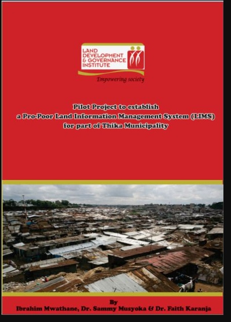
Pilot Project to establish a Pro-Poor Land Information Management System (LIMS) for part of Thika Municipality

Journal Articles & Books
Reports & Research
May, 2012
Kenya

According to 2001 statistics, 924 million people, almost one third of the world’s population lived in slums. A majority of these people are in the developing countries and they account for 43% of the urban population. Slums are characterized by a dense proliferation of small, makeshift shelters built from diverse materials, degradation of the local ecosystem and by severe social problems.

Handbook on Land Laws

Legislation & Policies
Legislation
National Policies
February, 2015
Kenya

The Land Act, 2012

The Land Registration Act, 2012

The National Land Commission Act, 2012

The Environment & Land Court Act, 2011

The Urban Areas & Cities Act, 2011

DEVELOPMENT AND IMPLEMENTATION OF THE LAND MANAGEMENT SYSTEM: AN IMPETUS OR A DETERRENT TO EFFECTIVE AND EFFICIENT LAND MANAGEMENT IN KENYA?

Journal Articles & Books
February, 2016
Kenya

A Land Information Management System (LIMS) is an information system that enables the capture, management, and analysis of geographically referenced land-related data in order to produce land information for decision-making in land administration and management. The system is a Geospatial Information System (GIS) driven for the purposes of handling and managing parcel based information. The Republic of Kenya, located in East Africa, ranks 33rd in the world in terms of population with 38.6 million people and has a land area of 224,081 square miles.

The Structure of Cadastral System in Kenya

Journal Articles & Books
May, 2013
Africa
Kenya

The cadastral system2 in Kenya was established in 1903 to cater for land alienation for the white settlers. Since then, a hundred years later, the structure of the system has remained more or less the same despite major changes in surveying technology. The government of Kenya has realized that the current structure is not conducive to economic demands of the 21st century and is interested in re-organizing the structure in line with the current constitutional dispensation and new paradigms in land management.

DEVELOPING LAND INFORMATION MANAGEMENT SYSTEM (LIMS) FOR COUNTY GOVERNMENTS IN KENYA: A CASE STUDY KIRINYAGA COUNTY.

Journal Articles & Books
February, 2017
Kenya

This paper describes the development of a Land Information Management System (LIMS) for County Governments in Kenya. In the new Constitution 2010, devolution of some national government functions and formation of county governments was provided for. These invoked the development of new land laws to guide the devolution processes and procedures. According to the County Government Act 2012, all County Governments are supposed to develop digital Geographic Information System (GIS) based spatial plans and these calls for development of LIMS for and efficient breakthrough.

AN EVALUATION OF THE CADASTRAL SYSTEM IN KENYA AND A STRATEGY FOR ITS MODERNIZATION

Reports & Research
July, 2013
Kenya

The Cadastral system in Kenya was established in 1903 to support land alienation for the white settlers who had come into the country in the early part of the 20th Century. In the last hundred years, the system has remained more or less the same, where land records are kept in paper format and majority of operations are carried out on a manual basis. The lack of a modern cadastral system has contributed to problems in land administration in the country.

Cadastral Systems and their Impact on Land Administration in Kenya

Journal Articles & Books
September, 2001
Kenya

The mandate of the Kenya Government in its objective to achieve sustainable development is to reduce poverty by half by 2015 and transform the country into a newly industrailized nation by the year 2020. This paper reviews the cadastral systems that have been formulated and implemented in Kenya ; the different concepts and techniques used in the preparation of cadastral survey plans and maps; and the impact of the cadastre as a source of spatial data in support of land administration processes.

The Structure of the Cadastral System in Kenya

Journal Articles & Books
June, 2013
Kenya

The cadastral system in Kenya was established in 1903 to cater for land alienation for the white settlers. Since then, a hundred years later, the structure of the system has remained more or less the same despite major changes in surveying technology. The government of Kenya has realized that the current structure is not conducive to economic demands of the 21st century and is interested in re-organizing the structure in line with the current constitutional dispensation and new paradigms in land management.

Perspective directions for performing the cadastral function of land resource management

Policy Papers & Briefs
December, 2010
Belarus

The cadastre structure in the system of land and real estate management is determined by existing and technologically dependent kinds of works and procedures on registration, recording and valuation of real estate. A general approach to land evaluation of all categories is a differential rent income taking into account natural characteristics and location of pieces of land.