Peasants' pursuit of outside alliances in the process of land reform a discussion of legal assistance programmes in Bangladesh and the Philippines

December, 1999
Bangladesh
Philippines
Rights and reality are women's equal rights to land, housing and property implemented in East Africa ?
Reports & Research
November, 2002
Eastern Africa
Kenya
Tanzania
Uganda
Rights and reality are women's equal rights to land, housing and property implemented in East Africa ?
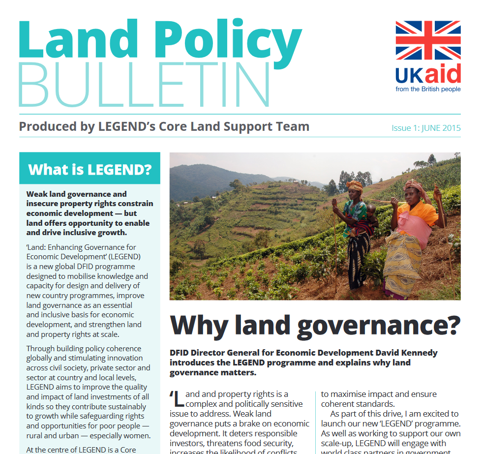
LEGEND Land Policy Bulletin 1
Policy Papers & Briefs
May, 2015
Global
DFID is delighted to launch the first Land Policy Bulletin, which introduces a new land and responsible investment programme - Land: Enhancing Governance for Economic Development (LEGEND).
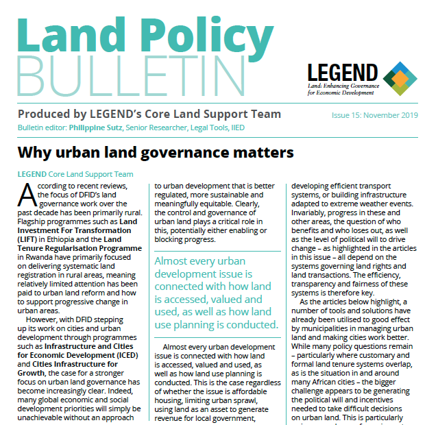
LEGEND Land Policy Bulletin 15
Policy Papers & Briefs
September, 2019
Global
According to recent reviews, the focus of DFID’s land governance work over the past decade has been primarily rural.
High-Resolution Vegetation Mapping in Japan by Combining Sentinel-2 and Landsat 8 Based Multi-Temporal Datasets through Machine Learning and Cross-Validation Approach
Peer-reviewed publication
September, 2017
Japan
This paper presents an evaluation of the multi-source satellite datasets such as Sentinel-2, Landsat-8, and Moderate Resolution Imaging Spectroradiometer (MODIS) with different spatial and temporal resolutions for nationwide vegetation mapping. The random forests based machine learning and cross-validation approach was applied for evaluating the performance of different datasets.
Understanding Pollinator Habitat Conservation under Current Policy Using Economic Experiments
Peer-reviewed publication
September, 2017
United States of America
Pollinators provide critical ecosystems services vital to the production of numerous crops in the United States’ agricultural sector. However, the U.S. is witnessing a serious decline in the abundance and diversity of domestic and wild pollinators, which threatens U.S. food security. In response, the U.S. Department of Agriculture has created the Pollinator Habitat Initiative (CP-42) to induce landowners to create quality habitat for pollinators by planting beneficial crops and wildflowers on Conservation Reserve Program (CRP)-eligible land.
Erratum: Viet Nguyen, L., Tateishi, R., Kondoh, A., Sharma, R.C., Thanh Nguyen, H., Trong To, T. and Ho Tong Minh, D. (2016). Mapping Tropical Forest Biomass by Combining ALOS-2, Landsat 8, and Field Plots Data. Land, 5(4), 31.
Peer-reviewed publication
September, 2017
Global
The authors would like to correct the following errors in Figure 1 in [1]: In the original publication data source is wrong in “Figure 1. [...]
Wolf and Bear Depredation on Livestock in Northern Sweden 1827–2014: Combining History, Ecology and Interviews
Peer-reviewed publication
September, 2017
Sweden
During the twenty-first century, large carnivores have increased in human dominated landscapes after being extinct or nearly extinct. This has resulted in increasing numbers of livestock killed by large carnivores. The intent of this paper is to give a land use-historical perspective on the recent livestock–carnivore conflict in boreal Sweden. More specifically we address: (1) depredation risks (livestock killed by carnivores) and (2) local knowledge of how to protect livestock from predation and whether it survived among pastoralists until the present.
The Sino-Brazilian Telecoupled Soybean System and Cascading Effects for the Exporting Country
Peer-reviewed publication
September, 2017
Brazil
China
The global food market makes international players intrinsically connected through the flow of commodities, demand, production, and consumption. Local decisions, such as new economic policies or dietary shifts, can foster changes in coupled human–natural systems across long distances. Understanding the causes and effects of these changes is essential for agricultural-export countries, such as Brazil. Since 2000, Brazil has led the expansion of soybean planted area—19 million hectares, or 47.5% of the world’s increase. Soybean is among the major crop commodities traded globally.
The Influence of Geology on Landscape Typology in Jordan: Theoretical Understanding and Planning Implications
Peer-reviewed publication
September, 2017
Jordan
Landscape Character Assessment (LCA) has been introduced into Jordan through the MEDSCAPES project. The purpose of this project was to streamline landscape studies and integrate them into the land use planning practices in Jordan. Two areas within the Mediterranean and arid climatic zones of the country were chosen as test areas for the methodology. These were the Yarmouk River drainage basin in the northwest of the country and the Mujib River area in the west of Jordan within the Dead Sea basin.