page search

IssuesscaleLandLibrary Resource
Displaying 157 - 168 of 583

Modern technology and sustainable irrigation of small scale dry-land farming in Kitui county, Kenya

Journal Articles & Books
December, 2015
Kenya

The Purpose of this study was to investigate the influence of technology on
sustainable irrigation of small scale dry land farming in Kitui Central District,
Kitui County, Kenya. The study sought to establish the extent to which adoption
of new irrigation technology, gravity free flow irrigation and access to access
to credit has influenced sustainable irrigation of small scale dry land farming.
Descriptive survey research design was adopted. A sample of 150 participants
was randomly selected from 1540 small-scale dry land irrigation farmers in the

Coupled Relationship between Rural Livelihoods and the Environment at a Village Scale: A Case Study in the Mongolian Plateau

Peer-reviewed publication
February, 2020
Global

Rural livelihoods, which are basic human activities, have long interacted with the environment. In light of the complexity of the human–environment system, more interdisciplinary analyses from geographical, environmental, and social sciences are needed. Using qualitative and quantitative methods from social, environmental, and geographical sciences, this study conducted a geographical regionalization and a comparative analysis of rural livelihoods in different zones in the Loess Plateau to explore the relationship between rural livelihoods and the environment.

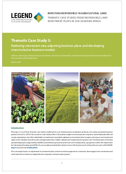
Reducing concession size, adjusting business plans and developing more inclusive business models

Reports & Research
February, 2020
Malawi
Mozambique
Western Africa
Ghana
Sierra Leone

This paper is one of three thematic case studies resulting from a set of pilot projects undertaken jointly by civil society and private business partners from 2016–2019 in five countries in sub-Saharan Africa. These pilots sought to test how private companies could collaborate with civil society organisations and other stakeholders to implement responsible agribusiness investments that recognise and respect community land rights, and to develop innovative tools and approaches that could be adopted and implemented at greater scale.

Actors, Scales and Spaces Dynamics Linked to Groundwater Resources use for Agriculture Production in Haouaria Plain, Tunisia. A Territory Game Approach

Peer-reviewed publication
March, 2020
Tunisia

Groundwater resources became a recognized enabler of important rural and socio-economic development in Mediterranean countries. However, the development of this groundwater economy is currently associated with an increased pressure on the available resource and negative implications on the socio-ecological system. Managing complex socio-ecological systems, such as those that occur in water resource management, is a multi-actor, multi-scale and dynamic decision-making process.

Not Affected the Same Way: Gendered Outcomes for Commons and Resilience Grabbing by Large-Scale Forest Investors in Tanzania

Peer-reviewed publication
April, 2020
Tanzania

The topic of large-scale land acquisition (LSLA) has attracted wide interest in the literature and the media. However, there is little work on the gendered institutional changes and gendered impacts on common pool resources (CPR) due to LSLA. The aim of this paper is to address these impacts.

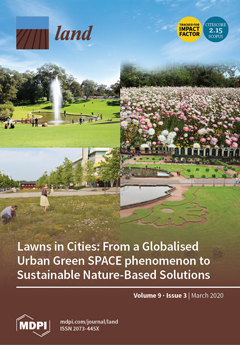
Landscape Strategy-Making and Collaboration. The Hills of Northern Mors, Denmark; A Case of Changing Focus and Scale

Peer-reviewed publication
June, 2020
Denmark
United States of America

This paper focuses on a three-year rural landscape strategy-making process, which was driven by a Danish municipality and involved a large number of stakeholders. The project was part of an action research program aimed at developing new approaches to collaborative landscape planning. Gaining experiences with such approaches was part of this aim. During the course of the project, the focus and scale of the strategy changed significantly. The process developed in interesting ways in respect to three dimensions of collaborative landscape planning: collaboration, scale, and public goods.

Utilizing Remotely Sensed Observations to Estimate the Urban Heat Island Effect at a Local Scale: Case Study of a University Campus

Peer-reviewed publication
June, 2020
Saudi Arabia

The urban heat island (UHI) effect has become a significant focus of research in today’s era of climate change, and a key consideration for the next generation of urban planning focused on green and livable cities. UHI has traditionally been measured using in situ data and ground-based measurements. However, with the increased availability of satellite-based thermal observations of the Earth, remotely sensed observations are increasingly being utilized to estimate surface urban heat island (SUHI), using land surface temperature (LST) as a critical indicator, due to its spatial coverage.

A Mixed Approach for Multi-Scale Assessment of Land System Dynamics and Future Scenario Development on the Vaucluse Department (Southeastern France)

Peer-reviewed publication
June, 2020
Australia
France
Norway

The Mediterranean Basin is at the same time a region of stark social and ecological contrasts and a global biodiversity hotspot, where complex local evolving land use and land cover patterns compose the region’s landscapes. In this context, we aimed for a specific case study of the southeast of France, to assess land and farming systems’ dynamics, to identify their underlying drivers, and to propose possible shared future scenarios for local policies’ implementation. We based our analyses on a mixed approach and operated at downscale from territorial to local scale.

Structural Variations in the Composition of Land Funds at Regional Scales across Russia

Peer-reviewed publication
June, 2020
Russia

In recent decades, Russia has experienced substantial transformations in agricultural land tenure. Post-Soviet reforms have shaped land distribution patterns but the impacts of these on agricultural use of land remain under-investigated. On a regional scale, there is still a knowledge gap in terms of knowing to what extent the variations in the compositions of agricultural land funds may be explained by changes in the acreage of other land categories.

Peace, Land, and Bureaucracy in Colombia: An Analysis of the Implementation of the Victims and Land Restitution Law from a Multiscale Perspective of State Bureaucracies

Peer-reviewed publication
June, 2020
Colombia
Norway

This article presents an analysis of the complexities implied by the implementation of the Colombian land restitution policy, as an example of the way in which the state works in its day-to-day practice. The document highlights the role played by the bureaucracy of “land” in the management of the so-called post-conflict setting. It is constructive in showing the multiscale nature of the state, whose operation cannot be understood outside the various levels and scales that compose it.

Assessment Method and Scale of Observation Influence Ecosystem Service Bundles

Peer-reviewed publication
September, 2020
Panama
Peru
United States of America

The understanding of relationships between ecosystem services and the appropriate spatial scales for their analysis and characterization represent opportunities for sustainable land management. Bundles have appeared as an integrated method to assess and visualize consistent associations among multiple ecosystem services. Most of the bundle assessments focused on a static framework at a specific spatial scale.

Refining the Tiered Approach for Mapping and Assessing Ecosystem Services at the Local Scale: A Case Study in a Rural Landscape in Northern Germany

Peer-reviewed publication
September, 2020
United Kingdom
Germany

Spatially explicit assessments of ecosystem services (ES) potentials are a key component in supporting a sustainable land use management. The ES matrix method is a commonly used approach as it allows for a comparably fast, comprehensible and accessible ES assessment. As it is often based on land use/land cover data (LULC) with no spatial variability, a main critique is that the results fail to assess spatial variability at landscape levels, which limits the reliability of the outputs for spatial planning applications.