Spatial analysis of soil fertility management using integrated household and GIS data from smallholder Kenyan farms
Although soil fertility is recognized as a primary constraint to agricultural production in developing countries, use of fertilizer in Sub-Saharan Africa is declining. Smallholder farmers still rely heavily on livestock manure for soil fertility management. To explore the determinants of soil fertility management practices, including both the use of cattle manure and inorganic fertilizer, data are used from a sample of 3,330 geo-referenced farm households across Central and Western Kenya. A bivariate probit model is applied to jointly examine the use of the two technologies.
Soil organic carbon dynamics, functions and management in West African agro-ecosystems
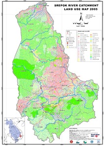
Srepok River Catchment Land Use Map 2005
Map details 50 land uses with a summary of the most common uses.
Soil organic carbon stocks in semi-arid West African drylands: implications for climate change adaptation and mitigation
In the West African drylands, SOC sequestration is seen as one of the prominent strategies to both enhance the resilience of agro-ecosystems and mitigate global greenhouse effects. However, there is a dearth of baseline data that impede the design of site-appropriate recommended management practices (RMPs) to improve and sustain SOC accrual.
Socioeconomic and technical considerations to mitigate land and water degradation in the Peruvian Andes
This project aims to increase agricultural productivity, incomes, and sustainable management of
land and water by small farmers in the rural Sierra region of Peru. Although results demonstrate
the effectiveness of increased productivity and commercialization of high value agricultural
commodities, this type of activity may be limited to certain parts of the watershed with access to
irrigation and startup capital. Interventions promoting commercialization, such as those of
Soil physical characteristics under different land use systems and duration on the Colombian savannas = Caractéristiques physiques de sols des savanes de Colombie en fonction de leur mode de mise en valeur et de leur ancienneté
Soil property changes over a 120-yr chronosequence from forest to agriculture in western Kenya
Much of the native forest in the highlands of western Kenya has been converted to agricultural land in order to feed the growing population, and more land is being cleared. In tropical Africa, this land use change results in progressive soil degradation, as the period of cultivation increases. Both rates and variation in infiltration, soil carbon concentration and other soil parameters are influenced by management within agricultural systems, but they have rarely been well documented in East Africa.
Summary of household baseline survey results: Lushoto, Tanzania
This report summarizes the results of a baseline household-?level survey, led by the CGIAR Research Program on Climate Change, Agriculture and Food Security (CCAFS), carried out in 7 villages and 140 households in Lushoto, Tanzania in January 2011. The objective of this baseline effort was to describe the characteristics of the farming systems found across a wide range of research sites in 12 countries, including the Lushoto site, and to better understand what kinds of farming practice changes households have been making and why.
Strengthening livelihood resilience in upper catchments of dry areas by integrated natural resources management
The Livelihood Resilience project evolved around the hypothesis that better integrated
management can improve the livelihoods of poor farming communities and increase the
environmental integrity and water productivity of upstream watersheds in dry areas. This
hypothesis was tested by researchers from different Iranian research and executive organizations
and farming communities in two benchmark research watersheds in upper Karkheh River Basin in
Iran, under the guidance of the ICARDA scientists. Participatory technology development, water,
Summary of CPWF research in the Nile river basin
Three major river basins flow out of Ethiopia into Sudan, constituting the Eastern Nile basin (the White Nile flows from the south). These are the Tekeze-Atbara flowing out of northern Ethiopia, the Baro-Akoba- Sobat flowing from southern Ethiopia, and the Blue Nile (Abay) sandwiched between the other two. The Blue Nile Basin, called the Abay in Ethiopia, is the largest branch of the Nile draining the Ethiopian highlands. It covers an estimated area of 311,437 square kilometers and is shared by Ethiopia and Sudan. It joins the White Nile in Khartoum, Sudan.


